Home » Adventures » Alaska » Misty Fiords
Route I Paddled
On my trip through the Inside Passage using the Alaska Marine Highway, I disembarked in Ketchikan to kayak in Misty Fiords National Monument. I wanted to visit this spot but was also using this excursion as a “shakedown” paddle for my upcoming Yukon River trip, despite Misty Fiords being a major kayaking destination and expedition in and of itself.
Most people visit Misty Fiords straight off a cruise ship by float plane and/or high speed catamaran. Those that do kayak generally take a water taxi at least part of the way to avoid possibly choppy, large channels and an otherwise long paddle. The water taxi was prohibitively expensive for me as a solo traveler though, so I went there under my own steam.

Before arriving in Alaska my information on this National Monument was quite basic, and although I waited out most of a weekend for the Forest Service office to open, they did not have great advice for an independent kayaker, as their focus seems to be on cruise ship passengers visiting the Southeast Alaska Discovery Center. At least I obtained a slightly better map. Southeast Sea Kayaks seems to be the knowledgeable people in town, but I never had a chance to speak with them. The encounter would have also been a bit odd since they are an outfitter, but I did not need any of their services, just to pick their brains. So with a limited amount of information and only moderate kayaking experience, I headed toward the ocean.
I stopped at the Southeast Alaska Discovery Center when they first opened to obtain better information for paddling in Misty Fiords National Monument. The people tried to help, but were more apt at dealing with cruise ship tourists rather than paddlers. I at least got a slightly better map and some questions answered. I then borrowed a SPOT for free from the Ketchikan Visitor Center before driving to the boat ramp at Mountain Point. After stowing my gear and donning lots of neoprene, I parked my car at a nearby gravel pullout, since the boat ramp had a 72 hour limit. I was not sure on the parking regulations for where my car was, but there were no signs, so hopefully it would not be ticketed or towed.
Here at this boat ramp in Alaska was only my second time in this kayak, and my first time fully packing all my gear inside. Everything fit at least, although my boat was not quite as roomy as I hoped.
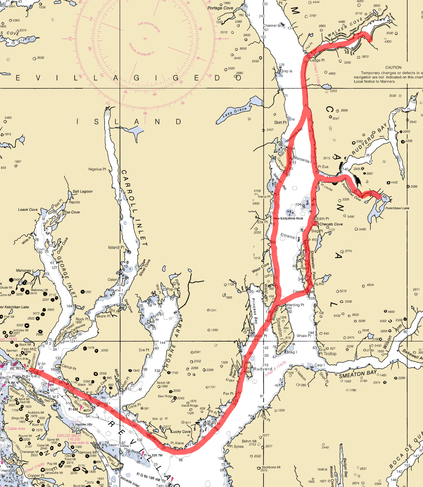
Coast near Alava Point
So I finally shoved off about 11 a.m. and within fifty yards of leaving the protected boat ramp I saw a bald eagle! I felt a little devious pleasure with sighting this bird so close too, since all the bus tours full of cruise ship passengers stop at this boat ramp (not sure why) and none of them would have seen it.1 By days end I had seen so many bald eagles though I stopped counting.
I started east on Revillagigedo Canal across Carroll and Thorne Inlets. I had a slight tailwind and current which really helped my progress. The small waves from the rear were a bit disconcerting sometime though, since I could not always see them coming. They also caused me to involuntarily surf with my kayak for very short distances a few times. Nothing I could not handle, but also not the most comfortable way to start a trip when I had not been in a kayak for while. And for what this canal could offer, these conditions were quite tame. I was a bit nervous that the weather might change in the days to come and severely hamper or delay my return.
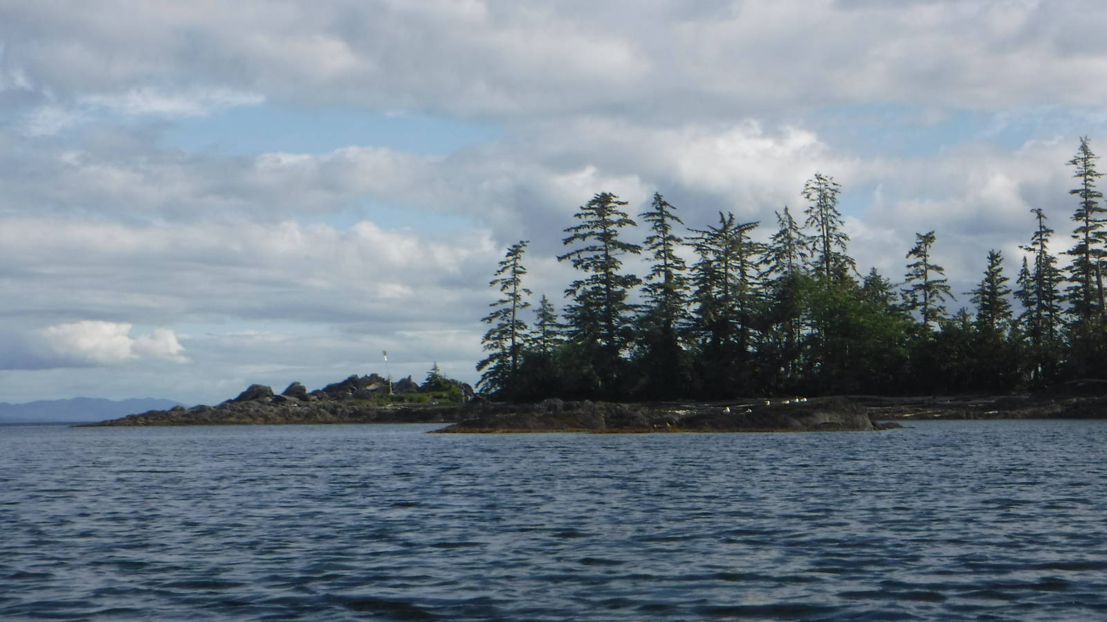
At the turn at Alava Point I started up Behm Canal. Very soon after entering I heard a big exhaust of air and water nearby, and I looked over to see the hump of a whale! I was around this underwater mammal for quite a while as I paddled up the canal. I watched it flash its hump above water as well as flip its tail many times.
A whale in Behm Canal
Rudyerd Island supposedly contained a campsite, so that was my planned goal for the night. Most of the shoreline in this entire area is cliffy, with dense forest encroaching right up to the high tide mark, so camping spots are quite limited. I sighted this island a ways off, but it grew larger excruciatingly slowly as my tired arms lacked any oomph. I was also fighting a bit of a tide. I eventually made it to the island after a long time, but did not see any place obvious to camp. While scouting the shore I finally located a spot on the west side of the island that I could make work for the night. Unfortunately the tide was low, so I had to carry my boat (the beach was too rocky to drag it) about 100 feet up the shore to stow it above the high tide mark for the night. The high tide mark was not entirely obvious either to this Midwesterner, so I erred on the side of caution for placing kayak. My boat fully loaded is too heavy for me to carry also, so I had to make several trips to move everything. On top of that I do not have an efficient routine down yet for kayaking, so I was a bit slow and unorganized setting up camp. Eventually all my night chores happened though, and I was grateful for sleep.
My arms held up better than expected for eight hours of kayaking without any real preparation. I never got around to doing a core/upper body routine post Hayduke and years of hiking have left my upper body with little strength. Still, my arms did not fall off. They were sore and tired, but not nearly as bad as my first time at the Apostle Islands.

I slept in and by the time I left the tide was even lower than last night so I had to drag my boat a bit further to reach the water. When I did get underway though, I was rewarded with a bunch of purple starfish clinging to the rocks. Sometimes they were solo, but oftentimes a big cluster were piled on top of one another. Various jelly fish also floated in the water as well as a few sea urchins sitting on the bottom.
As I headed up the west side of Behm Canal, I was now fighting a light, but steady headwind. The breeze was not strong, and in anything other than a kayak I probably would not have even noticed it, but given my mode of transportation this wind had quite the detrimental effect. I was a lot slower in the water and had to work much harder for each stroke. I had also underestimated just how much the tailwind aided me the day before on Revillagigedo Canal, so my distance per day estimates may have been a little optimistic. Right now Princess Bay was large enough and Smeaton Island far enough away that the wind mostly hit me unabated. The waves were at least small and not problematic, so I did not have to worry about stability.

I finally made it through Short Pass and stopped in a small cove just south of Wasp Cove for lunch. I knew the tide was coming in, but the speed at which the water came in as I sat there still amazed me. I could never fully relax and had to constantly keep an eye on my boat, as about every five minutes the water advanced enough that I had to drag it further up the shore. The rocky beach was not very sloped, but being able to watch the water continually advance right before my eyes was sometime to remember.
At least after lunch the wind mostly died down, so progress was not as painful and a lot quicker. The scenery around the canal was also very beautiful, with luscious forests on each side, mountains rising from the water, and snow still lingering on some peaks.
I passed through the narrow gap next to Manzanita Island (now fighting a bit of a current against the tide), but by the time I emerged the wind had picked up again. I started across Behm Canal (about 2 miles wide here) to the east bank and had quite a hard time doing it. The wind was enough to significantly hinder this kayaker. I could not let up paddling either, as if I did the wind would blow me back down the canal and turn me to face the small waves in the wrong direction. My trip across was one of those physics problems where I was paddling at a steep angle upstream, but my boat was going straight across the canal — at best. My trip to the opposite side took much longer than expected, and I was exhausted by the time I reached the other shore.
I faced the same challenge as last night for camping, with few obvious spots visible from the water. I luckily found a spot next to a freshwater stream, with room for precisely one tent. Again it was hard to tell exactly how high tide would go, but I was pretty sure my tent would not end up underwater.
I stayed on dry land overnight, although probably only by a few feet and headed for Walker Cove in the morning. A slight wind hit me in the face, but not enough to slow me down much. When I did reach Walker Cove, I was rewarded with some great views into the fiord, with tall rock walls rising nearly vertically from the water.
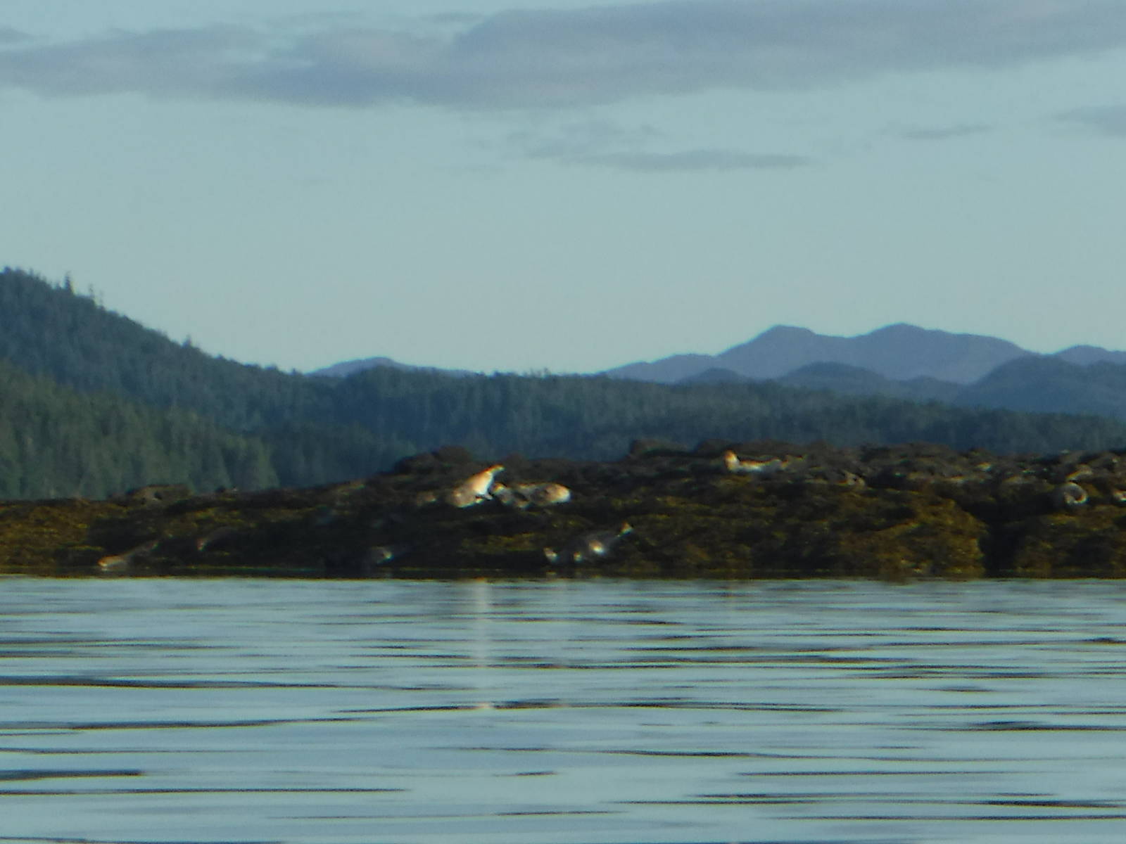
Seals
On my way into the cove I had a tailwind for once, with the tide even going in the correct direction as well. I made great time with very little effort. While admiring the towering rock walls, I saw some small heads bobbing in the water which then disappeared below the surface. Seals! These animals were mostly quite skittish, diving underwater when I was still a good distance off. The cove was filled with seals, and they were occasionally on every side of my boat! I let them be, but a few times one intentionally splashed the surface quite close to my boat. I am not sure if they were being aggressive, defensive, or just curious and playful. At least they never touched my kayak since they could have (even unintentionally) flipped me.
The day became very nice, and by midday it was too hot for me to wear my full paddle jacket. So I stripped to my short sleeve neoprene undershirt and got to breath and tan a bit more. I was not entirely sure if this was the right move for clothing though, as although the air was warm, the water was still cold enough to have to worry about hypothermia if I accidentally went in. So the jacket would help immensely in that catastrophe, but I also had to balance that out against overheating in that top if I kept it on.
I paddled about six miles into the amazing Walker Cove till I reached the salmon stream on the south side of the cove. Unfortunately the summer was still too young for any salmon to be spawning, so neither they, nor the bears which eat them, had arrived yet. At least the tide was high so I could float quite far up the stream. I reached well into the forest before the effect of the tide eventually disappeared and a small, impassable stream returned.
I turned around now and as I paddled out of the cove — now almost entirely inundated with water at high tide — I passed over a quite unusual phenomenon. A constant wall of small bubbles emerged from the seafloor in a narrow strip several feet long. It looked like the bottom was boiling or else an aerator from a very large fish tank. The water was cold to the touch, and I did not think I was trapped in a large aquarium though. This spot would have been dry ground an hour before, so I can only assume that water was seeping into some open cavity below the surface, with the air being expelled out the top. Still, with the volume of bubbles and for how long they were going on, that had to be quite a large reservoir. Or it was just magic. A very neat thing to see though, regardless of how it worked.

I was fortunate that the wind had calmed down so I had a relatively easy time leaving Walker Cove. Although some rain clouds had blown in and were stalking me, and they eventually caught up. I had an evening paddle in the rain, which was sometimes a heavy downpour. At least for paddling I was already setup for water protection, so rain was not as a big of deal as when hiking. Rain occurs a lot in this area anyway; it is not called Misty Fiords for nothing. I still hid out under some overhanging trees that acted as an almost impenetrable umbrella for the worst of the deluge though.
I camped at same spot as last night. I of course wanted to get further, but with all the fun in Walker Cove I was behind. Stopping time had already come and gone, and I knew a campsite was there, so I would have been foolish to keep going. Carrying all my gear back again to the same spot was annoying, but such is life and at least the tide was not quite as low as yesterday when I beached. Also, the rain took a long enough break for me to setup camp and eat dinner while staying mostly dry.
Light rain fell much of the night, but I stayed dry in my tent and the precipitation mostly stopped while loading my boat. The weather turned the fiords into a different kind of beautiful creature in the morning, with wispy clouds hugging the mountain tops. They looked ominous and mysterious now, with who knows what evils hidden behind the clouds.

As I approached Rudyerd Cove, I was accosted with the “D-Day Invasion” that occurs everyday in the summer as cruise ship passengers descend. Half a dozen float planes roared into the cove, greatly disturbing my wilderness experience. A high speed catamaran also passed through when I was in the cove itself. Planes continued to fly sporadically overhead all day, usually in groups. Most flew by without stopping, but one or two landed on the water.
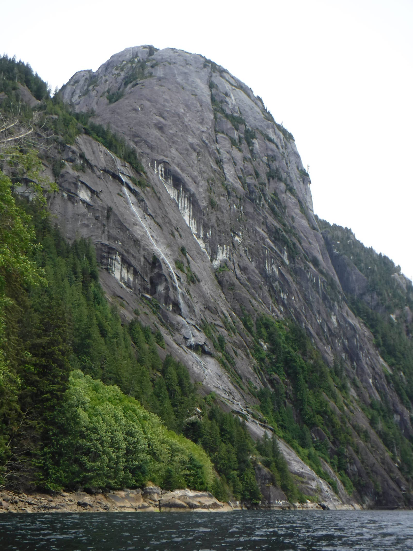
Despite the presence of combustion engines, Rudyerd Cove — specifically Punchbowl Cove — were amazing. Again a several thousand foot wall rose almost vertically from the water. It was awesome to admire and in the morning a few clouds still clung eerily to the tops.

Punchbowl Cove
I paddled into Punchbowl Cove and landed at he trailhead to hike up to Punchbowl Lake. After dragging up my boat to secure it against the rising tide, I scrambled up the steep, slick trail. Surprisingly, a real right of way had been constructed, with many boardwalks and other wooden structures making foot passage possible. This trail did not see regular maintenance, with much of the lumber mossy, a bit rotted, and overgrown. This passageway was still much better than a bush bash through a rain forest though. The tread was slippery, but my paddling booties were amazingly grippy on the slick surface. Halfway up a tall, powerful, and beautiful waterfall was beside the trail. Even further along was grizzly bear scat, although I never saw any bears.
Punchbowl Lake had yet even more sheer rock walls and was a beautiful body of water. The Forest Service left a canoe and rowboat at the lake for public use. The rowboat was quite leaky so I launched the canoe. Unfortunately I did not locate the canoe paddles until after I returned, so I used the unwieldy oars from the rowboat. I awkwardly paddled around the lake with the large oars, enjoying the scenery from a different type of human powered water transport. Time was limited for me to explore this large lake, but I got near the islands in the middle before turning back home.

Canoeing in Punchbowl Lake
Back at the bottom in Punchbowl Cove the tide was almost completely in, so at least my boat was near the water. The weather mostly cooperated too and back at Behm Canal the water was a flat surface of glass on which to paddle — my first time this trip. Although getting late, I took advantage of the weather and paddled on to Checats Cove. Some interesting, craggy cliffs with trees clinging to them were at the cove’s northern entrance, but even better was a good campsite located within its calm confines. A flat, clear spot perfectly sized for my tent was a welcome change from most of the shoreline terrain I had encountered. And although this cove was billed as “little visited,” two other vessels anchored in its sheltered waters overnight.

Checats Cove
I paddled around tiny Checats Cove in the morning, hoping to spot some bears, but had no such luck. So I continued down Behm Canal, back towards civilization. Shoalwater Pass, next to Winstanley Island, was the first notable feature, and I fought a bit of tidal current through this narrow passage. Upon emerging, the big water was calm, and I started to cross Behm Canal towards Smeaton Island. Partway across though, the wind once again picked up, and of course not in my favor. I had been lazy for much of the morning, never getting into a paddling rhythm and taking lots of breaks, but I had no such luxuries anymore with the breeze. I diverted through Short Pass, hoping to shield myself from the headwind as much as possible. The land only helped marginally though, so each stroke was still a struggle. I crossed Princess Bay, still fighting the wind, but as least the waves were small. I hugged the mainland, but this again only provided meager assistance. I also had to be careful not stay too close to shore, as the waves were much choppier there or else my boat might strike an unseen rock hidden below the surface.
I continued along the shoreline, making slow progress against the wind but eventually reached Alava Bay. I had hoped to use the cabin if it was available, so I was dismayed at a sailboat moored outside. Luckily though this vessel was just harboring and its passengers slept onboard, so the cabin was vacant! The tide was only halfway out as well, so I was able to drag my boat over the grass instead of having to laboriously unload all my gear and carry my kayak separately. The cabin was very nice, although spartan inside. The necessities were present though, with bunk platforms, tables, and a stove (which I did not need that night). I very much appreciated the solid structure with room to move around and was very happy to reside there for the night.

Alava Bay Cabin
For the first time this trip I awoke and was on the water at a reasonable hour. The call of town, my dwindling food stores, being in a cabin, and wanting to make the tide all helped get my butt out of bed. Unfortunately the weather still did not cooperate, with an even stronger headwind and more chop than last night. I could still make progress and did not feel unstable in the waves but was in for a very long day if these conditions persisted. I powered up the shoreline and around Alava Point, having to work hard and be cautious the whole time. Not until I reached the islands outside Lucky Cove could I finally take a break in their lee and rest my weary arms. Fortunately though, after rounding the point and changing direction, the wind was at my back. For once the weather and current were helping me! This change of fate made my existence so much easier, quicker, and less mentally stressful. I still had to paddle, but at least I continued to drift in the correct direction if I rested, as opposed to loosing ground as usual. And although the wind and waves were coming from behind, they were not problematic.
I reached the boat ramp at Thunder Point in the early afternoon, so thankful not to have been stuck at sea for hours longer since the wind was in my favor much of the way. Thankfully my car had not been ticketed or towed, so I loaded my boat on top and had a late lunch at Hole in the Wall Bar before heading back to masses of cruise ship passengers in Ketchikan.
Overall I had a good, if not exhausting, trip. I really enjoyed my time in Misty Fiords, as well as learning a lot of little things which should help on the Yukon River, where I will not have any options for gear changes. I was fortunate with the weather though. Although it felt like I fought a headwind about 80% of the trip, it was never a gale that became dangerous or forced me to shore. I also only had half a day of rain, which is a virtual drought in this rain forest. I did push my luck a bit, not leaving extra days in my schedule or food in my boat if the weather had temporarily stranded me. I also must reiterate that Misty Fiords is a major undertaking itself, and I (or anyone else) should have their gear dialed in beforehand, and not still going through the learning process. Still, despite being in a designated wilderness area in Alaska, I never felt that remote, with a steady stream of boat and float plane traffic keeping me company.
Misty Fiords was a great time and an amazing first stop in Alaska. The area was remarkable, with lots of animals above and below the water and awesome scenery. The only thing it could use is a few less loud float planes.